
Hello, I’m Tom Woolley, a map illustrator from the UK. I have over 12 years’ experience creating maps for international clients.
I create eye-catching illustrated maps and have worked with clients such as UNESCO, the Wildlife Trust, Northumberland National Park and Hilton Hotels.
Need help with an illustrated map? Get in touch
- 2D illustrated maps
- 3D illustrated maps
- Campus maps
- Character illustration
- Hotel maps
- Parks & nature maps
“Tom is always detailed-oriented and is simply a joy to work with”
View more client testimonials


Tom Woolley is a map illustrator who has created map designs for a wide selection of international clients. The map illustration service that Tom provides ensures visually attractive and easy-to-read maps. Over the past 12 years, Tom has produced maps in various categories and styles.
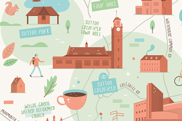
2D illustrated maps
Tom’s 2D maps range from bold and colourful city maps full of quirky details, to technical, geographically accurate site maps.
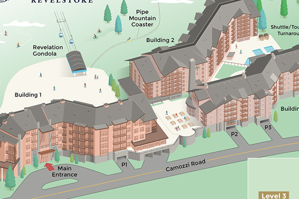
3D illustrated maps
For an accurate representation of the physical geography of a location, 3D maps are a perfect option. Check out Tom’s portfolio to see the different types of illustrated 3D maps he has designed.
Campus maps
Tom has created maps for Universities, Colleges and Schools around the world. The campus maps have been designed to be used in the prospectus and as an essential navigational tool for students and staff.
Hotel maps
Tom has worked with various hotels to create visitor maps for both print and digital. From fully-rendered 3D hotel maps, to 2D floor plans, Tom’s maps help hotel guests find their way around their new accommodation.
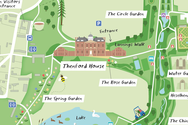
Parks and nature maps
Tom has created illustrated maps for National Parks, nature reserves, woodland walks, gardens and arboretums. Take a look at Tom’s parks and nature portfolio to see the different maps he’s designed.
How does a map illustrator approach a new map project?
If you’re thinking about commissioning an illustrated map, this article highlights options and styles to consider.